NILA GeoSolutions provides Innovative Reservoir Characterization and Seismic Data Analytic backed by experienced geologists, geophysicists and engineers. Whether our clients are planning the placement of new wells or looking to learn more about a reservoir potential we can help. This includes Geo steering wells for optimal placement, engineering completions for maximal production, and forecasting and simulating production.
Enhance Understanding of Reservoir Behavior
CONSULTATION SERVICES
In the oil and gas industry, 3-D reservoir modeling involves the construction of a computer model of a petroleum reservoir, for the purposes of improving estimation of reserves and making decisions regarding the development of the field, predicting future production, placing additional wells, and evaluating alternative reservoir management scenarios.
Reservoir models typically fall into two categories:
¶Geological models are created by geologists and geophysicists and aim to provide a static description of the reservoir, prior to production.
¶ Reservoir engineers create reservoir simulation models and use finite difference methods to simulate the flow of fluids within the reservoir, over its production lifetime.
Reservoir Simulation is an area of reservoir engineering in which computer models are used to predict the flow of formation fluids (typically oil, gas and water) through a porous medium. In more detail this means forecasting reservoir performance, flow rates, water break-through, reserves, history matching and understanding of flow mechanisms. Simulation studies performed at early stages of field development are done to estimate parameters such as optimal well spacing. At later stage, on producing fields, simulation is performed for infill well planning or secondary recovery.
NILA GeoSolutions Reservoir Engineers are familiar with most industry standard simulation packages. Our dedicated teams work closely together in Client’s premises, and are as a rule, closely interacting with Client’s project geologist, who is familiar with the geological setting of the modeled reservoir. This cooperation gives the best possible outcome and the best chance to meet Client’s objectives of optimum or increased hydrocarbon recovery. In the (infill) well planning process on a producing field, reservoir modeling is a powerful additional tool for the development geologist, but commonly not accepted by management as a stand-alone tool.
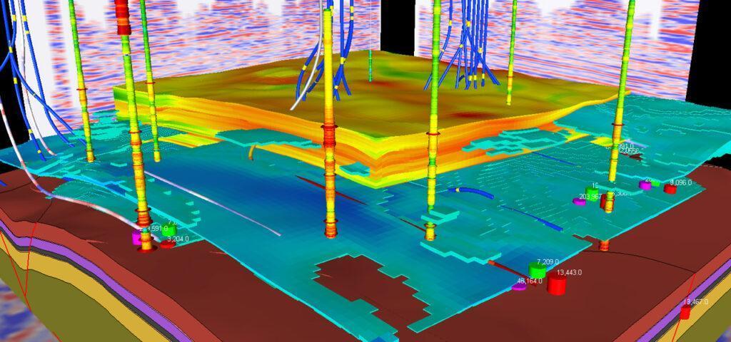
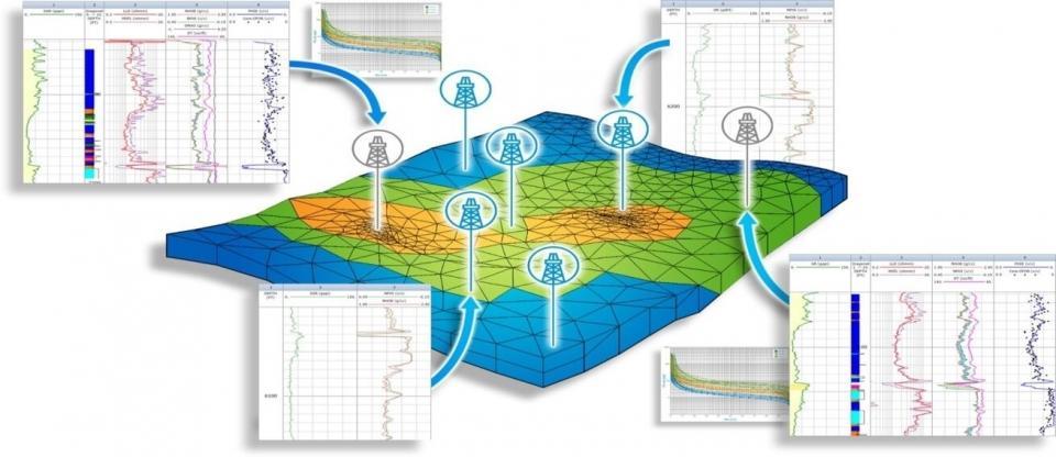
Well Correlations at Scale of Individual Reservoir Layers
OUR SERVICES
Since the static reservoir model forms the basis for the dynamic modeling by the engineer, it is of key importance that the reservoir correlation between wells is as accurate as possible at the smallest possible scale; the individual reservoir bed. This could reveal the presence of internal reservoir baffles, critical for the dynamic modeling.
Static Reservoir Modeling
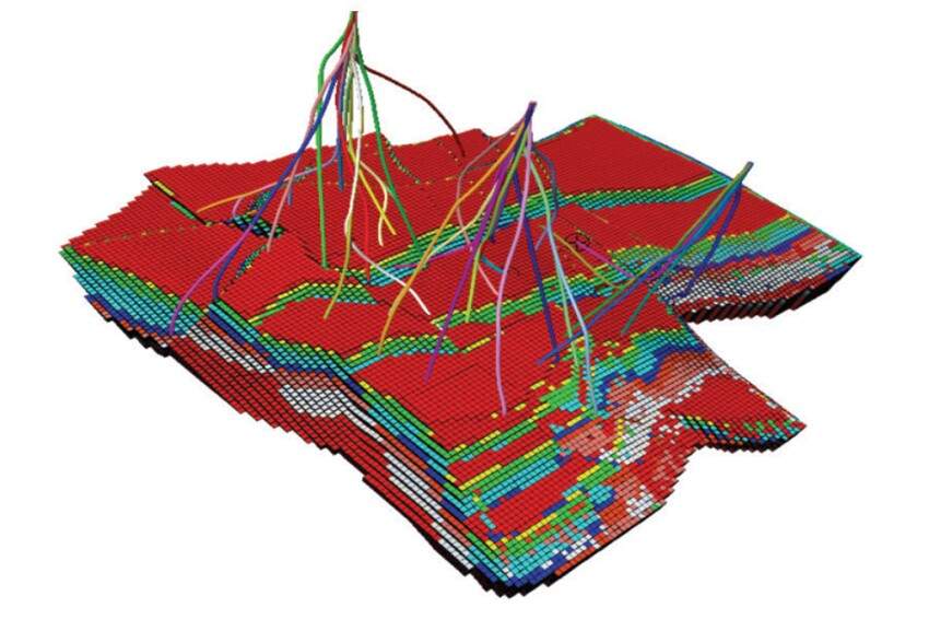
Once there is consensus on the geological framework of structure and reservoir architecture, the modeler starts constructing the static model by creating an array of discrete cells, delineated by a grid, which may be regular or irregular (see examples from the Niger Delta; the upper diagram showing modeled porosity, the lower diagram the modeled water saturation). The array of cells is usually three-dimensional, although 1D and 2D models are sometimes used.
All reservoir parameters/properties are integrated in the model: reservoir distribution (porosity, permeability, facies, internal baffles), HC saturation, fault connectivity, all derived from seismic- and well data. All these values are Geo-statistically attributed to each cell, whereby a specific property or attribute is applied uniformly throughout a specific cell. Commonly, these models are constructed at a relatively high (fine) resolution.
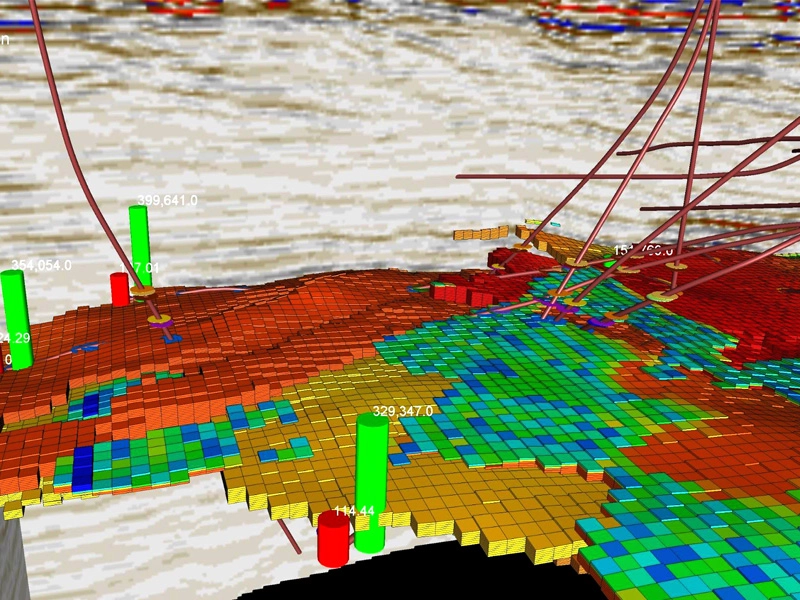
Dynamic Reservoir Modeling
As mentioned here fore, reservoir dynamic simulations are performed for reservoir management through forecasting of reservoir performance, improving reservoir description through history matching and understanding of flow mechanisms.
Uncertainty in the true values of the reservoir properties is sometimes investigated by constructing several different realizations of the sets of attribute values. The behavior of the resulting simulation models can then indicate the associated level of economic uncertainty. The outcome of different runs in simulation is a reality check of the validity of the static model. In particular, when the reservoir engineer is not able to reach a decent history match, it will tell us changes must be made to the static model. Workflows for integrated reservoir modeling are illustrated in the below diagram.
Team Work
NILA GeoSolutions dedicated GL/RE teams work closely together in Client’s premises. They are, as a rule, closely interacting with Client’s project geologist. During the modeling, all available data will be reviewed and integrated in order to give the optimum outcome and the best chance to meet Client’s main project objectives, which is to increase HC recovery from the reservoir